Introduction of Satellite Navigation Educational Instrument - Software Receiver
Overview
As an integral part of the navigation educational instrument, the software receiver is used to verify the accuracy of the signal source generated data, and provide the implement cases of satellite navigation receiver, allows users to be familiar with basic principles of satellite navigation signal receiving and processing, understanding the navigation receiver basic parameter, positioning algorithm processes etc.
Simulated signal source between and software receiver transfer data in time through TCP/IP protocol. Signal sources as server and software receivers as the client, to get data by request to the server, the software receiver could process satellite signal data generated by the signal source in real time.
Also, by changing the data source, playback modes can also be used to deal with stored data files. This platform can run on any regular computer, realize satellite signal processing in software-only platform, which is convenient to learn and use.
Introduction of software function
This software receiver is function-rich, most of the functions are realized through front-end interface and user interaction.
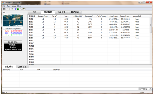
Basic status display of all channels, as shown in Figure 1, which shows the basic channel trace status,including the tracking satellite number of each channel , frequency component, channel tracing State (CCBF, respectively capture,chasing, bit synchronization, frame synchronization realization), and noise ratio of the channel tracked satellite, essential information such as Doppler frequency shift, carrier-phase, the launch time etc caused by the relative motion.

Figure 1 channel information display interface
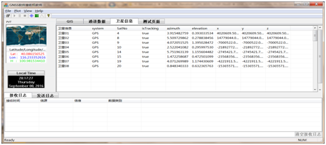
Satellite status information output, as shown in Figure 2, including satellite position, pitch&azimuth angle and so on. The information is given after analytical Almanac, position calculation, the software receiver background calculate the position of the satellite and pitch angle information according to the ephemeris and receiver locations, and finally transfer to the front end interface.

Figure 2 satellite status information display
next:没有了

